|
 Patrick, Robert and I set out to bag the two peaks
of the Shavano Group in August 2006. Robert and I met in Salida for a
quick dinner and met Patrick at the trailhead just as an incredible
heavy rain storm hit the area. We sat in my car and quickly decided
the better part of valor (or courage) was to sleep in the cars that night
instead of our tents. Our decision was ratified with a close-by lightning
strike and finalized with a ear-shatering thunder boom. Patrick, Robert and I set out to bag the two peaks
of the Shavano Group in August 2006. Robert and I met in Salida for a
quick dinner and met Patrick at the trailhead just as an incredible
heavy rain storm hit the area. We sat in my car and quickly decided
the better part of valor (or courage) was to sleep in the cars that night
instead of our tents. Our decision was ratified with a close-by lightning
strike and finalized with a ear-shatering thunder boom.
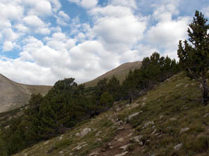
We choose the Blank Gulch trailhead since the "classic" Angle
of Shavano was nothing more than a long scree climb without the snow.
Leaving the trailhead at 5:30
AM on Saturday August 12 the weather had cleared leaving us with a mild,
humid summer morning in the Rockies. But
not all was well and after a few minutes Patrick decided to return to
the cars not feeling well. We have all been there.
 Robert and I continued higher. The trailhead
is at 9500' and we climbed 2,000' in the first hour. The trail follows
a small stream and wends in and out of small clearings but remains
below the treeline until 11,600'. Shavano's summit peaked out above
the trees. The trail was very rocky up to this point but generally well marked
and easy to follow even in the early morning light. As we broke
above treeline the trail turned to well worn dirt and took a direct
bearing for the saddle below Shavano. We continued to gain altitude
towards 13,000'. Robert and I continued higher. The trailhead
is at 9500' and we climbed 2,000' in the first hour. The trail follows
a small stream and wends in and out of small clearings but remains
below the treeline until 11,600'. Shavano's summit peaked out above
the trees. The trail was very rocky up to this point but generally well marked
and easy to follow even in the early morning light. As we broke
above treeline the trail turned to well worn dirt and took a direct
bearing for the saddle below Shavano. We continued to gain altitude
towards 13,000'.
The summit was obvious as a cone (left picture)
that rose 1,000' above the saddle. Soon we were in the boulders
of Shavano following a sometimes invisible trail. Some easy scrambling
was required as we climbed higher and higher. Then all of a sudden,
the angles lessened and we were on the summit ridge. Robert and
I stopped and looked at one another. "Are we here?" we almost asked
in unision. As we scanned the area looking for Tabeguache, we noted
another "summit"
a few hundred yards along the ridge. "Is that the summit?" we
asked. Then Robert made the understatement of the day "If this is the
summit, it sure is anti-climatic!" And he was correct - it was both.
 As the pictures show, there was
a low layer of dark clouds forming to the west and above us. We
spotted Tab (right picture) and noted it required a downclimb along
the ridge to the saddle 600' lower and then another 400' up to Tab's
summit. We debated our exposure on the ridge. It would take at least
one and half hours for the round trip and another hour to get back
to treeline. The lightening last night was close, sharp and dangerous
so we did not want to be caught above treeline if a storm developed. As the pictures show, there was
a low layer of dark clouds forming to the west and above us. We
spotted Tab (right picture) and noted it required a downclimb along
the ridge to the saddle 600' lower and then another 400' up to Tab's
summit. We debated our exposure on the ridge. It would take at least
one and half hours for the round trip and another hour to get back
to treeline. The lightening last night was close, sharp and dangerous
so we did not want to be caught above treeline if a storm developed.
 Robert observed that there was no real organization
of the clouds and there were patches of blue sky so we decided to
go for it. We made it to the saddle in 20 minutes and up to Tab's
in another 15. Making such good time, we took a break and enjoyed
the views. I took my summit video and we had some lunch. The clouds
were rising from the lower valleys and it made for a nice 3D look on an otherwise
dull and gray day. The ridge off Shav was impressive (left picture). Robert observed that there was no real organization
of the clouds and there were patches of blue sky so we decided to
go for it. We made it to the saddle in 20 minutes and up to Tab's
in another 15. Making such good time, we took a break and enjoyed
the views. I took my summit video and we had some lunch. The clouds
were rising from the lower valleys and it made for a nice 3D look on an otherwise
dull and gray day. The ridge off Shav was impressive (left picture).
Not wanting to push our luck we left Tab for the saddle and soon
were traversing Shav's rocky summit. We stayed below the ridge
and wound up not really following a trail but rather did a long
rock scramble circumnavigating 200' lower than the summit
to the east. It was actually more interesting than following the
established trail along the ridge.
 We reached the saddle, treeline and soon
were back in the forest. The pine trees were quite fragrant. There were
a few more people now. We were almost alone as we started the day. We reached the saddle, treeline and soon
were back in the forest. The pine trees were quite fragrant. There were
a few more people now. We were almost alone as we started the day.
 OK,
another 14er or two in the bag. To be honest, this was not my most enjoyable
climb from a 14er perspective. The trail below treeline was nice but
the climb to Shav's summit was ordinary. The traverse over to Tab was
good but the reversal back over Shav and down was not really exciting. OK,
another 14er or two in the bag. To be honest, this was not my most enjoyable
climb from a 14er perspective. The trail below treeline was nice but
the climb to Shav's summit was ordinary. The traverse over to Tab was
good but the reversal back over Shav and down was not really exciting.
What made it worthwhile was climbing with good friends.
|